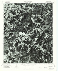
1976 Map of Denver
USGS Topo · Published 1978About this map
Denver serves as the focal point of this 1976 orthophotograph, illustrating a transitional landscape in eastern Lincoln County during the mid-1970s. This aerial perspective, produced by the Department of Natural Resources and Community Development, reveals a distinct pattern of rural intersections and family-named hubs. Several prominent junctions including Drums Crossroads, Olivers Crossroads, and Killian Crossroads anchor the surrounding timberlands and agricultural clearings. The terrain is defined by the drainage systems of Anderson Creek and the larger Mountain Creek, with the photographic detail capturing the precise density of forest cover and the winding road network connecting these historic communities before the significant suburban expansion of later decades.
Find a feature on this map
6 named features on this map. Tap any name to fly to it.
Don’t see what you’re looking for? This feature index may not catch every label — zoom into the map to look around manually.
Map Details
Editions of this 1976 Denver Map
This is the sole edition of this map. No revisions or reprints were ever made.
Other maps of this area

1893 · Statesville
USGS Topo · 1:125,000

1895 · Hickory
USGS Topo · 1:125,000

1914 · Gastonia
USGS Topo · 1:48,000

1916 · Gastonia
USGS Topo · 1:62,500

1941 · Charlotte
USGS Topo · 1:125,000

1942 · Charlotte
USGS Topo · 1:125,000

1949 · Hicks Crossroads
USGS Topo · 1:24,000

1953 · Charlotte
USGS Topo · 1:250,000

1954 · Charlotte
USGS Topo · 1:250,000

1960 · Charlotte
USGS Topo · 1:250,000