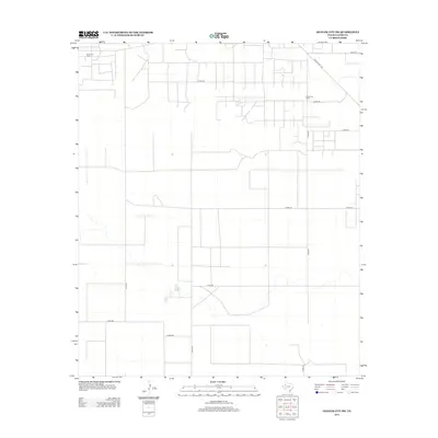
2012 Map of Denver City SW
USGS Topo · Published 2012About this map
The energy-rich landscape of West Texas is defined by the extraction infrastructure of the Brown Oil Field and the Russell Oil Field in this corner of Gaines County. This survey reflects the region's industrial geometry, where the flat terrain is partitioned by an extensive network of straight-line section roads and county routes. Principal transit is anchored by Ranch Road 1757 in the northeast, while a dense grid of local paths such as Co Rd-218, Co Rd-206, and Co Rd-231 provide access to numerous well sites and petroleum facilities. The map illustrates the intense development of the Permian Basin, showing how oil production and transport routes dominate the rural topography, with water features being notably sparse in this arid environment.
Find a feature on this map
13 named features on this map. Tap any name to fly to it.
Don’t see what you’re looking for? This feature index may not catch every label — zoom into the map to look around manually.
Map Details
Editions of this 2012 Denver City SW Map
This is the sole edition of this map. No revisions or reprints were ever made.
Other maps of this area

1954 · Hobbs
USGS Topo · 1:250,000

1958 · Hobbs
USGS Topo · 1:250,000

1969 · Hobbs East
USGS Topo · 1:24,000

1969 · Humble City NE
USGS Topo · 1:24,000

1969 · Humble City SE
USGS Topo · 1:24,000

1970 · Humble City SE
USGS Topo · 1:24,000

1971 · Paynes Corner
USGS Topo · 1:24,000

1971 · Higginbotham
USGS Topo · 1:24,000
1971 · Denver City
USGS Topo · 1:24,000

1971 · Denver City SW
USGS Topo · 1:24,000