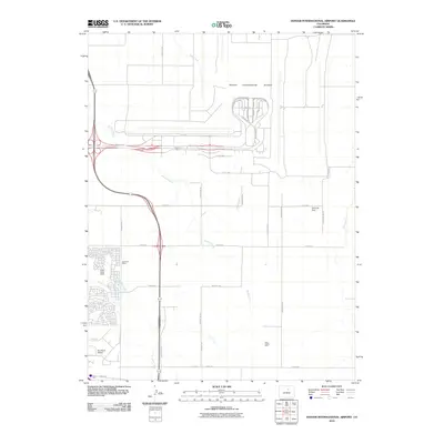
2010 Map of Denver International Airport
USGS Topo · Published 2010About this map
Denver International Airport dominates this 2010 landscape, its complex layout of runways and terminals including Shady Grove St and N Patsburg St positioned near the Terminal Dam. The map captures a moment of intense transition where modern aviation infrastructure meets the area's agricultural and industrial roots. Traces of an earlier economy are visible in the southern and western portions of the quadrangle, where the Scranton Mine and Two Shafts Mine indicate the region's historical subsurface activity. Residential expansion is noted in the growing neighborhood of Green Valley Ranch, while the older Highline Canal and the smaller Sky Ranch Airport provide a sharp contrast to the massive international hub to the north. Multiple drainages, including Third Creek, Second Creek, and First Creek, carve through the prairie terrain, illustrating the natural geography that dictated the placement of early ranching and mining operations before the massive 21st-century development.
Find a feature on this map
41 named features on this map. Tap any name to fly to it.
Don’t see what you’re looking for? This feature index may not catch every label — zoom into the map to look around manually.
Map Details
Editions of this 2010 Denver International Airport Map
This is the sole edition of this map. No revisions or reprints were ever made.
Other maps of this area

1890 · East Denver
USGS Topo · 1:125,000

1935 · East Denver Nos. 3 and 4
USGS Topo · 1:48,000

1938 · Long Branch
USGS Topo · 1:24,000

1939 · Coal Creek
USGS Topo · 1:24,000

1940 · Brighton
USGS Topo · 1:31,680

1941 · Long Branch
USGS Topo · 1:31,680

1941 · Fitzsimons
USGS Topo · 1:31,680

1942 · Mile High Lakes
USGS Topo · 1:31,680

1942 · Box Elder School
USGS Topo · 1:31,680

1942 · Coal Creek
USGS Topo · 1:31,680