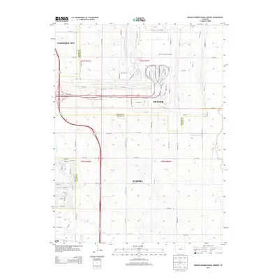
2013 Map of Denver International Airport
USGS Topo · Published 2013About this map
Denver International Airport dominates the northern landscape of this survey, showcasing its intricate terminal and runway layout near the intersection of the Adams Co Denver Co line. This early 21st-century study captures the rapid suburban expansion and infrastructure development at the eastern edge of the metropolitan area. The high-capacity corridor of Pena Blvd serves as the primary artery connecting the airport to the expanding residential grids of Aurora and Denver to the south.
Find a feature on this map
115 named features on this map. Tap any name to fly to it.
Don’t see what you’re looking for? This feature index may not catch every label — zoom into the map to look around manually.
Map Details
Editions of this 2013 Denver International Airport Map
This is the sole edition of this map. No revisions or reprints were ever made.
Other maps of this area

1890 · East Denver
USGS Topo · 1:125,000

1935 · East Denver Nos. 3 and 4
USGS Topo · 1:48,000

1938 · Long Branch
USGS Topo · 1:24,000

1939 · Coal Creek
USGS Topo · 1:24,000

1940 · Brighton
USGS Topo · 1:31,680

1941 · Long Branch
USGS Topo · 1:31,680

1941 · Fitzsimons
USGS Topo · 1:31,680

1942 · Mile High Lakes
USGS Topo · 1:31,680

1942 · Box Elder School
USGS Topo · 1:31,680

1942 · Coal Creek
USGS Topo · 1:31,680