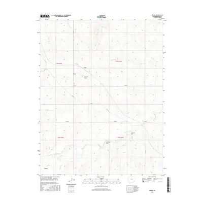
2016 Map of Deora
USGS Topo · Published 2016About this map
Deora and Frick sit at the intersection of long-established section roads in this corner of the High Plains, where the landscape is defined by the subtle drainage patterns of Two Butte Creek. The map shows a highly structured agricultural and ranching environment, with a grid of county roads such as Co RD SS and Co RD 6 providing access to the wide-open spaces between the watercourses. The local geography is marked by significant natural depressions and erosion features, including Shell Rock Canyon and Arrasmith Draw. These landforms, along with the presence of Alkali Spring, illustrate the semi-arid character of the region and the critical importance of water management in eastern Colorado. Further south, the settlement of Atlanta is located near the banks of Freezout Cr, positioned amidst the various draws like Antelope Draw that channel runoff toward the larger creek systems.
Find a feature on this map
29 named features on this map. Tap any name to fly to it.
Don’t see what you’re looking for? This feature index may not catch every label — zoom into the map to look around manually.
Map Details
Editions of this 2016 Deora Map
This is the sole edition of this map. No revisions or reprints were ever made.
Other maps of this area

1891 · Higbee
USGS Topo · 1:125,000

1891 · Springfield
USGS Topo · 1:125,000

1892 · Two Butte
USGS Topo · 1:125,000

1892 · Mt Carrizo
USGS Topo · 1:125,000

1893 · Higbee
USGS Topo · 1:125,000

1893 · Two Butte
USGS Topo · 1:125,000

1893 · Springfield
USGS Topo · 1:125,000

1955 · La Junta
USGS Topo · 1:250,000

1958 · La Junta
USGS Topo · 1:250,000

1968 · La Junta
USGS Topo · 1:250,000