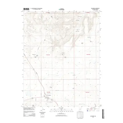
2013 Map of Des Moines
USGS Topo · Published 2013About this map
Des Moines serves as the primary hub of this high-altitude landscape, centered near the intersection of the Folsom Hwy and several local routes like Archuleta Rd. The town's community infrastructure is well-defined, including the Po, a Catholic Ch, and the nearby Des Moines Cem. To the northwest, the settlement of Los Lujanes sits at the base of the dramatic volcanic terrain that characterizes the region.
Find a feature on this map
41 named features on this map. Tap any name to fly to it.
Don’t see what you’re looking for? This feature index may not catch every label — zoom into the map to look around manually.
Map Details
Editions of this 2013 Des Moines Map
This is the sole edition of this map. No revisions or reprints were ever made.
Other maps of this area

1954 · Dalhart
USGS Topo · 1:250,000

1958 · Dalhart
USGS Topo · 1:250,000

1962 · Dalhart
USGS Topo · 1:250,000

1972 · Emery Peak
USGS Topo · 1:24,000

1972 · Little Grande
USGS Topo · 1:24,000
1972 · Cross L Ranch
USGS Topo · 1:24,000

1972 · Cross L Ranch SW
USGS Topo · 1:24,000
1972 · Des Moines
USGS Topo · 1:24,000

1972 · Capulin
USGS Topo · 1:24,000
1972 · Folsom
USGS Topo · 1:24,000