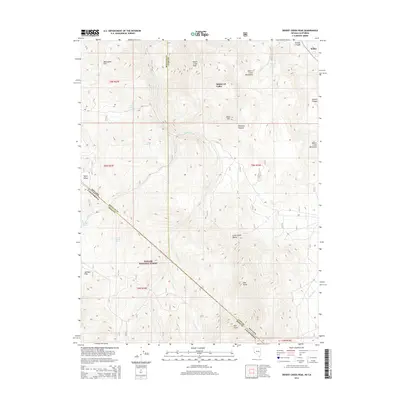
2014 Map of Desert Creek Peak
USGS Topo · Published 2014About this map
Desert Creek Peak dominates this high-altitude landscape along the border where Nevada and California meet in the eastern Sierra. The map details a transition from the lower elevations of Smith Valley and Little Smith Valley up into the protected heights of the Toiyabe National Forest. This region is defined by its complex hydrology, featuring numerous isolated water sources such as O'Banion Spring and Fourth of July Spring, which supported livestock and early ranching efforts in these high basins.
Find a feature on this map
33 named features on this map. Tap any name to fly to it.
Don’t see what you’re looking for? This feature index may not catch every label — zoom into the map to look around manually.
Map Details
Editions of this 2014 Desert Creek Peak Map
This is the sole edition of this map. No revisions or reprints were ever made.
Other maps of this area

1891 · Wellington
USGS Topo · 1:125,000

1893 · Wellington
USGS Topo · 1:125,000

1909 · Bridgeport
USGS Topo · 1:125,000

1911 · Bridgeport
USGS Topo · 1:125,000

1920 · Bridgeport
USGS Topo · 1:125,000

1948 · Walker Lake
USGS Topo · 1:250,000

1954 · Chris Flat
USGS Topo · 1:24,000

1956 · Desert Creek Peak
USGS Topo · 1:62,500

1956 · Fales Hot Springs
USGS Topo · 1:62,500

1957 · Walker Lake
USGS Topo · 1:250,000