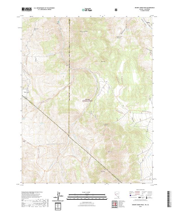
2021 Map of Desert Creek Peak
USGS Topo · Published 2021About this map
Desert Creek Peak dominates this high-altitude landscape along the border of Nevada and California, serving as a central point for a complex network of seasonal water sources and historic trails. The map reveals a remote terrain defined by the Sweetwater Mountains and Desert Creek Mountains, where ancient pathways like the Lobdell Lake - Jackass Flat Rd Trl and Rickey Mine Route Trl suggest a long history of exploration and extraction. The presence of Wiley Ditch on the eastern edge indicates early water management efforts to sustain life in this arid environment.
Find a feature on this map
47 named features on this map. Tap any name to fly to it.
Don’t see what you’re looking for? This feature index may not catch every label — zoom into the map to look around manually.
Map Details
Editions of this 2021 Desert Creek Peak Map
This is the sole edition of this map. No revisions or reprints were ever made.
Other maps of this area

1891 · Wellington
USGS Topo · 1:125,000

1893 · Wellington
USGS Topo · 1:125,000

1909 · Bridgeport
USGS Topo · 1:125,000

1911 · Bridgeport
USGS Topo · 1:125,000

1920 · Bridgeport
USGS Topo · 1:125,000

1948 · Walker Lake
USGS Topo · 1:250,000

1954 · Chris Flat
USGS Topo · 1:24,000

1956 · Desert Creek Peak
USGS Topo · 1:62,500

1956 · Fales Hot Springs
USGS Topo · 1:62,500

1957 · Walker Lake
USGS Topo · 1:250,000