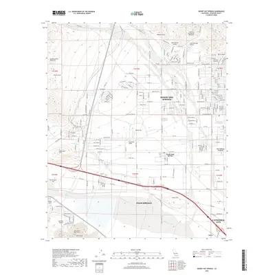
2018 Map of Desert Hot Springs
USGS Topo · Published 2018About this map
Desert Hot Springs and the surrounding Coachella Valley are defined by a complex network of alluvial washes and dramatic mountain boundaries in this 2018 survey. The landscape transitions from the southern reaches of the San Bernardino Mountains and Devils Garden toward the floor of the Coachella Valley. Critical infrastructure is evident throughout the terrain, most notably the Colorado River Aqueduct traversing the northeast corner and a dense web of utility lines along Power Line Rd. The map documents the spatial relationship between established communities like Palm Springs and Cathedral City against natural landmarks such as Garnet Hill and the Whitewater River. Localized features including North Palm Springs, Dos Palmas Corners, and the remote settlement of Salvia illustrate the varied settlement patterns dictated by the region's arid geography and major transportation corridors through the San Gorgonio Pass.
Find a feature on this map
205 named features on this map. Tap any name to fly to it.
Don’t see what you’re looking for? This feature index may not catch every label — zoom into the map to look around manually.
Map Details
Editions of this 2018 Desert Hot Springs Map
This is the sole edition of this map. No revisions or reprints were ever made.
Other maps of this area

1901 · Southern California Sheet No. 1
USGS Topo · 1:250,000

1901 · San Jacinto
USGS Topo · 1:125,000

1902 · San Gorgonio
USGS Topo · 1:125,000

1904 · Southern California Sheet No. 1
USGS Topo · 1:250,000

1940 · Palm Springs
USGS Topo · 1:62,500

1941 · Edom
USGS Topo · 1:62,500

1944 · Palm Springs
USGS Topo · 1:62,500

1944 · Edom
USGS Topo · 1:62,500

1947 · Santa Ana
USGS Topo · 1:250,000

1949 · Santa Ana
USGS Topo · 1:250,000