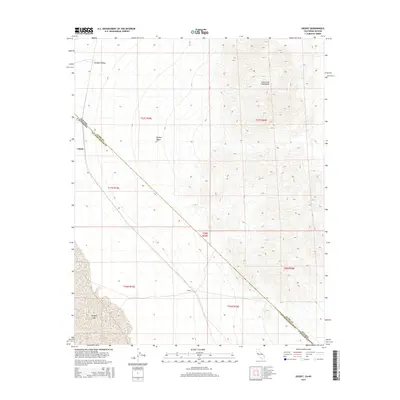
2015 Map of Desert
USGS Topo · Published 2015About this map
Lucy Gray Mountains dominate the eastern topography of this desert landscape, where the arid expanse of the Mojave Desert meets the state line. The diagonal boundary between Nevada and California bisects the quadrangle, passing through the Ivanpah Valley and near the settlement of Calada. To the south, the dry bed of Ivanpah Lake provides a stark contrast to the surrounding alluvial fans and mountain slopes. The map traces the infrastructure through this corridor, including the small outpost of Desert, illustrating the modern management of this interstate borderland. The township and range lines of t17n r15e and t27s r59e reveal the systematic grid overlaying the natural features of San Bernardino County.
Find a feature on this map
15 named features on this map. Tap any name to fly to it.
Don’t see what you’re looking for? This feature index may not catch every label — zoom into the map to look around manually.
Map Details
Editions of this 2015 Desert Map
This is the sole edition of this map. No revisions or reprints were ever made.
Other maps of this area

1910 · Ivanpah
USGS Topo · 1:250,000

1912 · Ivanpah
USGS Topo · 1:250,000

1942 · Ivanpah
USGS Topo · 1:250,000

1947 · Kingman
USGS Topo · 1:250,000

1948 · Kingman
USGS Topo · 1:250,000

1954 · Kingman
USGS Topo · 1:250,000

1955 · Kingman
USGS Topo · 1:250,000

1955 · Roach Lake
USGS Topo · 1:62,500

1956 · Ivanpah
USGS Topo · 1:62,500
1956 · Crescent Peak
USGS Topo · 1:62,500