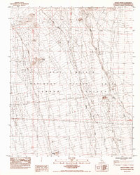
1984 Map of Desert Spring
USGS Topo · Published 1986About this map
Desert Spring sits at the heart of this mid-1980s survey, marking a vital water point in the arid expanse of the Mojave National Scenic Area. The landscape is dominated by the broad, sweeping alluvial fans of the Fenner Valley, where seasonal drainage systems like Black Canyon Wash and Woods Wash illustrate the complex desert hydrology of eastern San Bernardino County. The map captures a moment when traditional desert landmarks intersected with modern infrastructure, such as the Single Steel Tower Transmission Line and an Underground Pipeline Gas that cut across the valley floor. These industrial additions follow the natural contours of the terrain, providing a look at how utility corridors were established through this protected region during the late twentieth century.
Find a feature on this map
12 named features on this map. Tap any name to fly to it.
Don’t see what you’re looking for? This feature index may not catch every label — zoom into the map to look around manually.
Map Details
Editions of this 1984 Desert Spring Map
2 editions found
Other maps of this area

1910 · Ivanpah
USGS Topo · 1:250,000

1912 · Ivanpah
USGS Topo · 1:250,000

1942 · Ivanpah
USGS Topo · 1:250,000

1942 · Amboy
USGS Topo · 1:250,000

1943 · Amboy
USGS Topo · 1:250,000

1943 · Fenner
USGS Topo · 1:62,500

1947 · Kingman
USGS Topo · 1:250,000

1948 · Kingman
USGS Topo · 1:250,000

1954 · Needles
USGS Topo · 1:250,000

1954 · Kingman
USGS Topo · 1:250,000