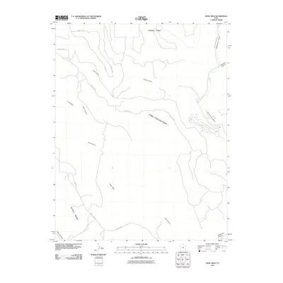
2010 Map of Devil Mesa
USGS Topo · Published 2010About this map
Devil Mesa dominates the central landscape of this San Juan County region, defined by its high plateaus and the deep drainages that carve through the desert floor. The map highlights a network of dramatic overlooks, including Dodge Point and Alkali Point, which provide vantage points over the surrounding canyon systems. To the east, the perennial path of Montezuma Creek snakes through Montezuma Canyon, serving as a primary hydrological feature in an otherwise arid environment.
Find a feature on this map
20 named features on this map. Tap any name to fly to it.
Don’t see what you’re looking for? This feature index may not catch every label — zoom into the map to look around manually.
Map Details
Editions of this 2010 Devil Mesa Map
This is the sole edition of this map. No revisions or reprints were ever made.
Other maps of this area

1886 · Abajo
USGS Topo · 1:250,000

1892 · Abajo
USGS Topo · 1:250,000

1893 · Abajo
USGS Topo · 1:250,000

1955 · Verdure 4 NW
USGS Topo · 1:24,000

1955 · Verdure 2 SE
USGS Topo · 1:24,000

1955 · Verdure 3 SE
USGS Topo · 1:24,000

1955 · Verdure 1 SW
USGS Topo · 1:24,000

1955 · Verdure 4 SW
USGS Topo · 1:24,000

1955 · Verdure 3 NE
USGS Topo · 1:24,000

1956 · Cortez
USGS Topo · 1:250,000