1955 Map of Verdure 4 SW
USGS Topo · Published 1955About this map
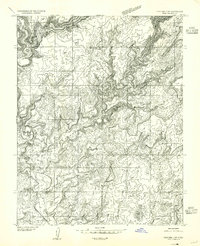
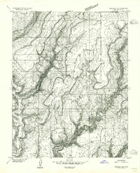
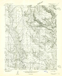
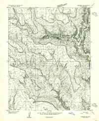
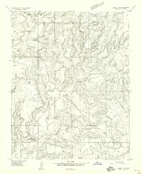
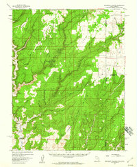
Perkins Ranch and the deep drainage of Montezuma Creek characterize this high-desert plateau in San Juan County during the mid-1950s. The landscape is a complex network of canyons, including Bug Canyon, Mesa Canyon, and Monte Canyon, where early human history is recorded at Cliff Dwellings and Cliff Dwelling Petroglyphs. These archaeological sites indicate a long-standing pattern of habitation tied to the sparse water resources of the region.
Find a feature on this map
15 named features on this map. Tap any name to fly to it.
Don’t see what you’re looking for? This feature index may not catch every label — zoom into the map to look around manually.
Map Details
Editions of this 1955 Verdure 4 SW Map
This is the sole edition of this map. No revisions or reprints were ever made.
Other maps of this area

1886 · Abajo
USGS Topo · 1:250,000

1892 · Abajo
USGS Topo · 1:250,000

1893 · Abajo
USGS Topo · 1:250,000
1955 · Verdure 4 NW
USGS Topo · 1:24,000
1955 · Verdure 3 SE
USGS Topo · 1:24,000
1955 · Verdure 3 NE
USGS Topo · 1:24,000

1956 · Cortez
USGS Topo · 1:250,000

1957 · Aneth 1 NE
USGS Topo · 1:24,000
1957 · Aneth 1 NW
USGS Topo · 1:24,000
1957 · Monument Canyon
USGS Topo · 1:62,500