1957 Map of Aneth 1 NW
USGS Topo · Published 1958About this map
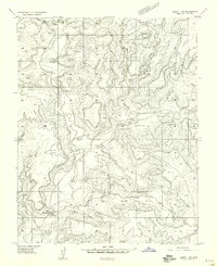
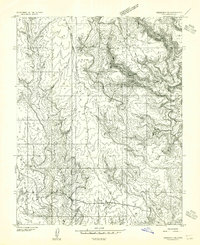
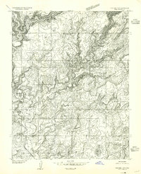
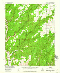
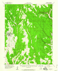
Montezuma Canyon and McCracken Mesa dominate this high-desert landscape in southeastern Utah during the late 1950s. The map captures a transition period in San Juan County, documenting the specific cultural footprint of the Hatch Trading Post and the nearby Hatch Trailer School. These labels, alongside the presence of Hogans and Hogan structures further south, reflect the localized habitation patterns of the Navajo and local settlers in this arid region.
Find a feature on this map
25 named features on this map. Tap any name to fly to it.
Don’t see what you’re looking for? This feature index may not catch every label — zoom into the map to look around manually.
Map Details
Editions of this 1957 Aneth 1 NW Map
This is the sole edition of this map. No revisions or reprints were ever made.
Other maps of this area

1886 · Abajo
USGS Topo · 1:250,000

1892 · Abajo
USGS Topo · 1:250,000

1893 · Abajo
USGS Topo · 1:250,000
1955 · Verdure 3 SE
USGS Topo · 1:24,000
1955 · Verdure 4 SW
USGS Topo · 1:24,000

1956 · Cortez
USGS Topo · 1:250,000

1957 · Aneth 1 NE
USGS Topo · 1:24,000
1957 · Monument Canyon
USGS Topo · 1:62,500
1957 · Blanding
USGS Topo · 1:62,500

1958 · Cortez
USGS Topo · 1:250,000