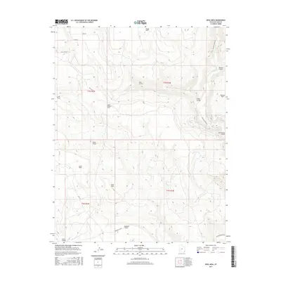
2017 Map of Devil Mesa
USGS Topo · Published 2017About this map
Devil Mesa rises as a prominent high-desert landform within the intricate drainage systems of San Juan County. This 2017 survey details a landscape defined by deep, winding incisions including Montezuma Canyon and Bradford Canyon, which channel the intermittent flows of the region. The map illustrates a complex network of topographical features such as Dodge Point and Long Point, alongside named corridors like Pearson Canyon and Alkali Canyon. Transportation through this arid terrain is facilitated by unpaved routes like Montezuma Creek Rd and Co RD 190, providing access to high overlooks at Alkali Point and Long Canyon Point. The layout of section lines across these canyons reflects the enduring influence of the Public Land Survey System on modern land management in southeastern Utah.
Find a feature on this map
25 named features on this map. Tap any name to fly to it.
Don’t see what you’re looking for? This feature index may not catch every label — zoom into the map to look around manually.
Map Details
Editions of this 2017 Devil Mesa Map
This is the sole edition of this map. No revisions or reprints were ever made.
Other maps of this area

1886 · Abajo
USGS Topo · 1:250,000

1892 · Abajo
USGS Topo · 1:250,000

1893 · Abajo
USGS Topo · 1:250,000

1955 · Verdure 4 NW
USGS Topo · 1:24,000

1955 · Verdure 2 SE
USGS Topo · 1:24,000

1955 · Verdure 3 SE
USGS Topo · 1:24,000

1955 · Verdure 1 SW
USGS Topo · 1:24,000

1955 · Verdure 4 SW
USGS Topo · 1:24,000

1955 · Verdure 3 NE
USGS Topo · 1:24,000

1956 · Cortez
USGS Topo · 1:250,000