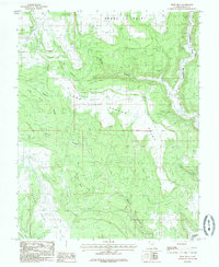
1985 Map of Devil Mesa
USGS Topo · Published 1985About this map
Devil Mesa dominates the central landscape of this Utah quadrangle, a prominent high-ground feature defined by the deep erosion of the surrounding drainage systems. In the mid-1980s, the area remained a complex network of high points and branching drainages, including Dodge Point to the north and Alkali Point to the southwest. The hydrological pattern is defined by Montezuma Creek flowing through Montezuma Canyon, which receives numerous tributaries such as Pearson Canyon.
Find a feature on this map
14 named features on this map. Tap any name to fly to it.
Don’t see what you’re looking for? This feature index may not catch every label — zoom into the map to look around manually.
Map Details
Editions of this 1985 Devil Mesa Map
This is the sole edition of this map. No revisions or reprints were ever made.
Other maps of this area

1886 · Abajo
USGS Topo · 1:250,000

1892 · Abajo
USGS Topo · 1:250,000

1893 · Abajo
USGS Topo · 1:250,000

1955 · Verdure 4 NW
USGS Topo · 1:24,000

1955 · Verdure 2 SE
USGS Topo · 1:24,000

1955 · Verdure 3 SE
USGS Topo · 1:24,000

1955 · Verdure 1 SW
USGS Topo · 1:24,000

1955 · Verdure 4 SW
USGS Topo · 1:24,000

1955 · Verdure 3 NE
USGS Topo · 1:24,000

1956 · Cortez
USGS Topo · 1:250,000