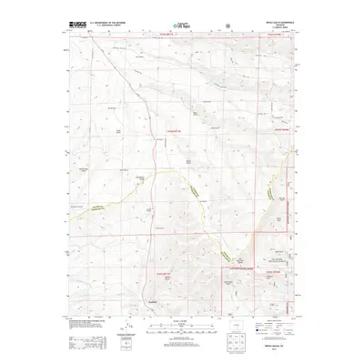
2013 Map of Devils Gulch
USGS Topo · Published 2013About this map
Bradford lies at the southern edge of this high-altitude landscape, situated where the Co-69 highway cuts through the terrain near the junction of Muddy Cr. The map reveals a land defined by water management and livestock ranching, evidenced by the numerous named windmills such as Hess Windmill, Robsin Windmill, and Cordrey Windmill that dot the drainages. These features, along with the Akin Ranch, suggest a persistent ranching economy in a region where seasonal creeks like Froze Cr and Sheep Cr provide critical water sources.
Find a feature on this map
54 named features on this map. Tap any name to fly to it.
Don’t see what you’re looking for? This feature index may not catch every label — zoom into the map to look around manually.
Map Details
Editions of this 2013 Devils Gulch Map
This is the sole edition of this map. No revisions or reprints were ever made.
Other maps of this area

1889 · Canon City
USGS Topo · 1:125,000

1889 · Huerfano Park
USGS Topo · 1:125,000

1892 · Huerfano Park
USGS Topo · 1:125,000

1892 · Canon City
USGS Topo · 1:125,000

1954 · Rosita
USGS Topo · 1:24,000

1954 · Trinidad
USGS Topo · 1:250,000

1954 · Pueblo
USGS Topo · 1:250,000

1955 · Trinidad
USGS Topo · 1:250,000

1957 · Pueblo
USGS Topo · 1:250,000

1957 · Aldrich Gulch
USGS Topo · 1:24,000