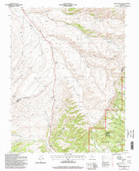
1994 Map of Devils Gulch
USGS Topo · Published 1998About this map
San Isabel National Forest dominates the southern reaches of this landscape, where high-altitude water sources like Trever Spring and Mud Spring feed into the complex drainage of Muddy Creek. The terrain is defined by the sharp transition between the Wet Mountain Valley and the high ridges of the Promontory Divide, a natural boundary that separates the watersheds of Devils Gulch and Foster Gulch.
Find a feature on this map
40 named features on this map. Tap any name to fly to it.
Don’t see what you’re looking for? This feature index may not catch every label — zoom into the map to look around manually.
Map Details
Editions of this 1994 Devils Gulch Map
This is the sole edition of this map. No revisions or reprints were ever made.
Other maps of this area

1889 · Canon City
USGS Topo · 1:125,000

1889 · Huerfano Park
USGS Topo · 1:125,000

1892 · Huerfano Park
USGS Topo · 1:125,000

1892 · Canon City
USGS Topo · 1:125,000

1954 · Rosita
USGS Topo · 1:24,000

1954 · Trinidad
USGS Topo · 1:250,000

1954 · Pueblo
USGS Topo · 1:250,000

1955 · Trinidad
USGS Topo · 1:250,000

1957 · Pueblo
USGS Topo · 1:250,000

1957 · Aldrich Gulch
USGS Topo · 1:24,000