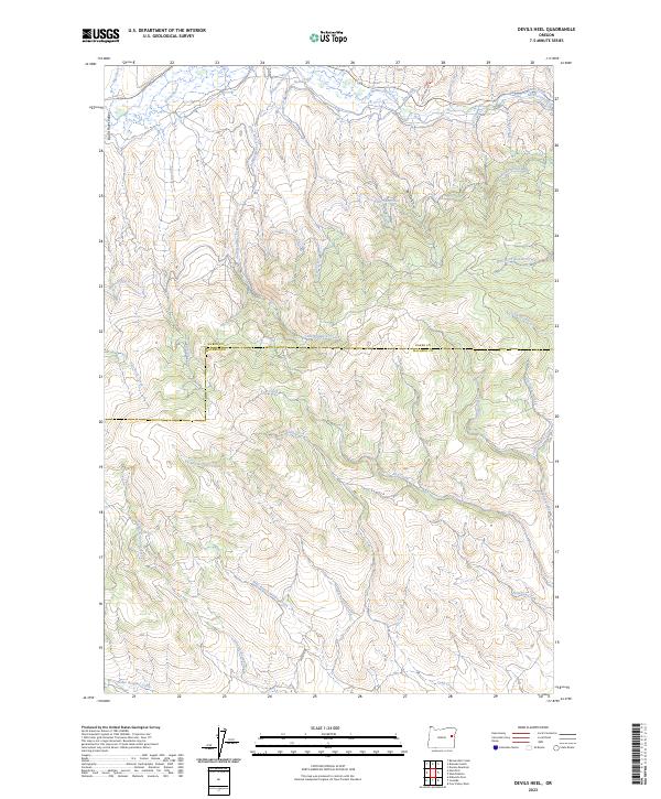
2023 Map of Devils Heel
USGS Topo · Published 2023About this map
The Burnt River Valley serves as a focal point for this high-elevation landscape along the border of Baker and Malheur counties. A complex system of water engineering, including the Eldorado Ditch and the McPherson Ditch, indicates the historical importance of water rights and management in this high-desert environment. These ditches, along with the Independence Creek Ditch, represent significant human interventions designed to divert flow from the Burnt River and its tributaries to support mining or agricultural interests in the surrounding basins.
Find a feature on this map
36 named features on this map. Tap any name to fly to it.
Don’t see what you’re looking for? This feature index may not catch every label — zoom into the map to look around manually.
Map Details
Editions of this 2023 Devils Heel Map
This is the sole edition of this map. No revisions or reprints were ever made.
Other maps of this area

1901 · Baker City
USGS Topo · 1:125,000

1901 · Sumpter
USGS Topo · 1:125,000

1908 · Ironside Mountain
USGS Topo · 1:125,000

1955 · Baker
USGS Topo · 1:250,000

1955 · Canyon City
USGS Topo · 1:250,000

1959 · Baker
USGS Topo · 1:250,000

1959 · Canyon City
USGS Topo · 1:250,000

1964 · Ironside
USGS Topo · 1:62,500

1967 · Dooley Mtn
USGS Topo · 1:24,000
1967 · Brannan Gulch
USGS Topo · 1:24,000