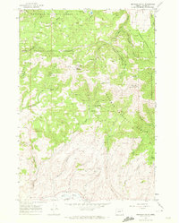
1967 Map of Brannan Gulch
USGS Topo · Published 1972About this map
Whitman National Forest dominates this landscape in Baker County, Oregon, during the late 1960s. The area is defined by sharp topographic relief, punctuated by high points such as Black Mtn and Little Bald Mtn. The Bald Mtn Lookout sits as a lonely sentinel overlooking a network of deep drainages, including Denny Creek and Corner Creek.
Find a feature on this map
39 named features on this map. Tap any name to fly to it.
Don’t see what you’re looking for? This feature index may not catch every label — zoom into the map to look around manually.
Map Details
Editions of this 1967 Brannan Gulch Map
3 editions found
Other maps of this area

1901 · Baker City
USGS Topo · 1:125,000

1901 · Sumpter
USGS Topo · 1:125,000

1908 · Ironside Mountain
USGS Topo · 1:125,000

1955 · Baker
USGS Topo · 1:250,000

1955 · Canyon City
USGS Topo · 1:250,000

1959 · Baker
USGS Topo · 1:250,000

1959 · Canyon City
USGS Topo · 1:250,000

1964 · Ironside
USGS Topo · 1:62,500

1967 · Dooley Mtn
USGS Topo · 1:24,000

1967 · Blue Canyon
USGS Topo · 1:24,000