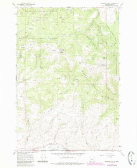
1967 Map of Brannan Gulch
USGS Topo · Published 1985About this map
Whitman National Forest land dominates this high-altitude survey of the Blue Mountains, showing a landscape defined by industrial resource extraction and complex water management. The southern portion of the quadrangle is marked by the Burnt River and an extensive Ditch system, likely diverted for the numerous Mine and Prospect sites that dot the drainages of Brannan Gulch and Browns Gulch. These small-scale excavations, including those near Indian Gulch and Pine Creek, reflect a persistent history of prospecting in Baker County. High points like Bald Mtn, featuring the Bald Mtn Lookout RM 1, provide strategic vantage points over the heavily timbered terrain. The map also documents a network of primitive transportation, with numerous 4wd tracks connecting remote springs such as Black Mountain Spring and Frog Spring to the higher ridges of Little Bald Mtn and Black Mtn.
Find a feature on this map
33 named features on this map. Tap any name to fly to it.
Don’t see what you’re looking for? This feature index may not catch every label — zoom into the map to look around manually.
Map Details
Editions of this 1967 Brannan Gulch Map
3 editions found
Other maps of this area

1901 · Baker City
USGS Topo · 1:125,000

1901 · Sumpter
USGS Topo · 1:125,000

1908 · Ironside Mountain
USGS Topo · 1:125,000

1955 · Baker
USGS Topo · 1:250,000

1955 · Canyon City
USGS Topo · 1:250,000

1959 · Baker
USGS Topo · 1:250,000

1959 · Canyon City
USGS Topo · 1:250,000

1964 · Ironside
USGS Topo · 1:62,500

1967 · Dooley Mtn
USGS Topo · 1:24,000

1967 · Blue Canyon
USGS Topo · 1:24,000