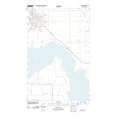
2011 Map of Devils Lake
USGS Topo · Published 2011About this map
Devils Lake dominates the southern landscape of this 2011 survey, its sprawling shoreline shaping the development of the surrounding Ramsey County terrain. The northern portion of the map is defined by a dense grid of streets and avenues including Walnut St E and 85th Ave Ne, marking the northward expansion of the regional hub. Local history and genealogy interest is anchored by the GAR Cemetery, located just east of the central street grid. Further east, the small settlement of Keith sits along the rail corridor, illustrating the dispersed rural hamlets that characterize the North Dakota prairie. The transition from the structured residential grid to the irregular, water-carved banks of the lake is traced by routes like Lake View Dr, which follows the contours of the rising water levels.
Find a feature on this map
36 named features on this map. Tap any name to fly to it.
Don’t see what you’re looking for? This feature index may not catch every label — zoom into the map to look around manually.
Map Details
Editions of this 2011 Devils Lake Map
This is the sole edition of this map. No revisions or reprints were ever made.
Other maps of this area

1928 · Tokio
USGS Topo · 1:62,500

1930 · Hamar
USGS Topo · 1:62,500

1931 · Tokio
USGS Topo · 1:62,500

1931 · Devils Lake
USGS Topo · 1:62,500

1950 · Tokio
USGS Topo · 1:24,000

1950 · Devils Lake
USGS Topo · 1:62,500

1951 · Crary
USGS Topo · 1:24,000

1951 · Devils Lake
USGS Topo · 1:24,000

1951 · Grand Harbor
USGS Topo · 1:24,000

1951 · Camp Grafton
USGS Topo · 1:24,000