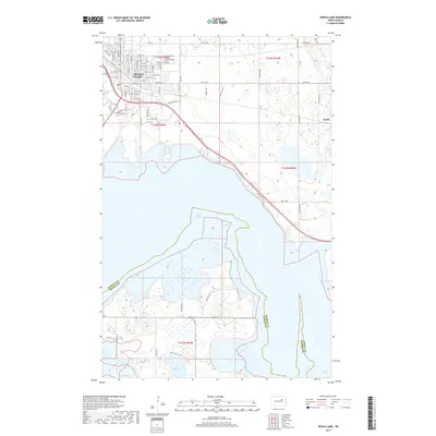
2017 Map of Devils Lake
USGS Topo · Published 2017About this map
Devils Lake sits at the northern edge of its namesake waters, showing the modern street grid of the city including Walnut St E, Kemp Ave, and Armour St SE. The map captures the complex interaction between the rising basin of Devils Lake and the surrounding Ramsey County landscape, where the Ramsey and Benson County line crosses through the water south of the city center. This 2017 survey details the extensive wetlands and fluctuating shoreline that define the region, reaching down toward Mission Bay.
Find a feature on this map
42 named features on this map. Tap any name to fly to it.
Don’t see what you’re looking for? This feature index may not catch every label — zoom into the map to look around manually.
Map Details
Editions of this 2017 Devils Lake Map
This is the sole edition of this map. No revisions or reprints were ever made.
Other maps of this area

1928 · Tokio
USGS Topo · 1:62,500

1930 · Hamar
USGS Topo · 1:62,500

1931 · Tokio
USGS Topo · 1:62,500

1931 · Devils Lake
USGS Topo · 1:62,500

1950 · Tokio
USGS Topo · 1:24,000

1950 · Devils Lake
USGS Topo · 1:62,500

1951 · Crary
USGS Topo · 1:24,000

1951 · Devils Lake
USGS Topo · 1:24,000

1951 · Grand Harbor
USGS Topo · 1:24,000

1951 · Camp Grafton
USGS Topo · 1:24,000