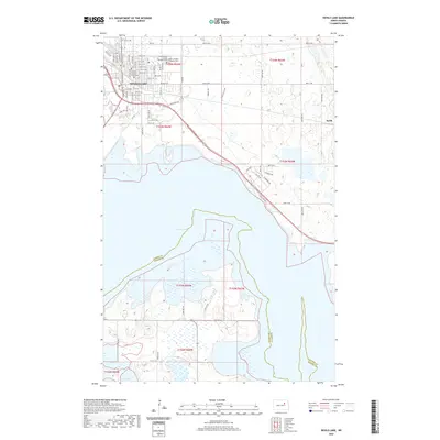
2020 Map of Devils Lake
USGS Topo · Published 2020About this map
Devils Lake serves as the regional hub in this 2020 landscape, characterized by the intricate relationship between the city and its namesake water body. The city's civic core is anchored by the Ramsey County Courthouse, while its historical depth is visible in the presence of the Grand Army of the Republic Cem and the Saint Joseph's Catholic Cem to the north. The shoreline of Devils Lake is marked by a mix of residential developments and open terrain, with neighborhood names like Lake View Dr and Bert Blvd defining the eastern banks. To the south, the water expands into Mission Bay, crossing the boundary between Ramsey and Benson Counties. The map reflects a modern era of lake-oriented living and agricultural transition, with the small community of Keith situated on the eastern edge of the quadrangle.
Find a feature on this map
47 named features on this map. Tap any name to fly to it.
Don’t see what you’re looking for? This feature index may not catch every label — zoom into the map to look around manually.
Map Details
Editions of this 2020 Devils Lake Map
This is the sole edition of this map. No revisions or reprints were ever made.
Other maps of this area

1928 · Tokio
USGS Topo · 1:62,500

1930 · Hamar
USGS Topo · 1:62,500

1931 · Tokio
USGS Topo · 1:62,500

1931 · Devils Lake
USGS Topo · 1:62,500

1950 · Tokio
USGS Topo · 1:24,000

1950 · Devils Lake
USGS Topo · 1:62,500

1951 · Crary
USGS Topo · 1:24,000

1951 · Devils Lake
USGS Topo · 1:24,000

1951 · Grand Harbor
USGS Topo · 1:24,000

1951 · Camp Grafton
USGS Topo · 1:24,000