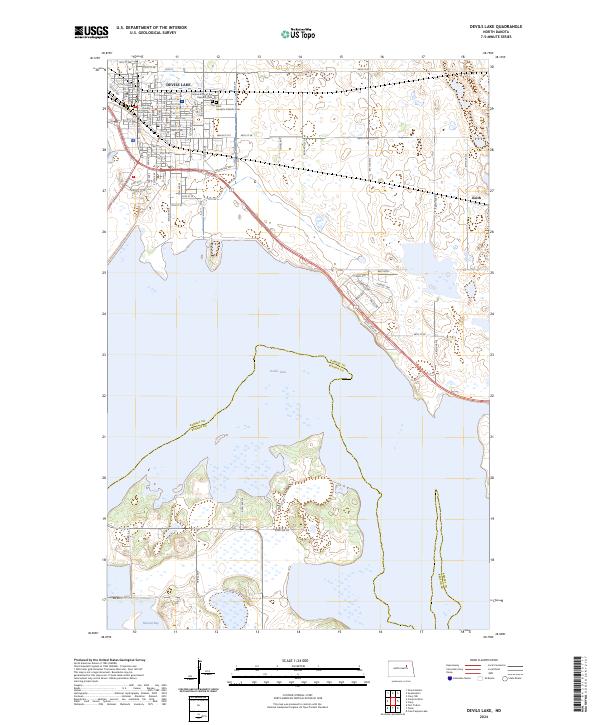
2024 Map of Devils Lake
USGS Topo · Published 2024About this map
The city of Devils Lake serves as the focal point of this North Dakota landscape, showing an organized grid of streets including 1st St NE and Walnut St E. For local historians and genealogists, the map preserves the location of the Grand Army of the Republic Cem and Saint Joseph's Catholic Cem, alongside the Ramsey County Courthouse. The surrounding area is characterized by the complex shoreline and wetlands associated with Devils Lake and Mission Bay, which cross the border between Ramsey and Benson Counties. Significant portions of the terrain are dedicated to conservation, notably the Benson County Waterfowl Production Area and the Ramsey County Waterfowl Production Area. To the east, the small settlement of Keith sits near the edge of these protected prairie wetlands, reflecting the region's long-standing connection to migratory bird habitats.
Find a feature on this map
51 named features on this map. Tap any name to fly to it.
Don’t see what you’re looking for? This feature index may not catch every label — zoom into the map to look around manually.
Map Details
Editions of this 2024 Devils Lake Map
This is the sole edition of this map. No revisions or reprints were ever made.
Other maps of this area

1928 · Tokio
USGS Topo · 1:62,500

1930 · Hamar
USGS Topo · 1:62,500

1931 · Tokio
USGS Topo · 1:62,500

1931 · Devils Lake
USGS Topo · 1:62,500

1950 · Tokio
USGS Topo · 1:24,000

1950 · Devils Lake
USGS Topo · 1:62,500

1951 · Crary
USGS Topo · 1:24,000

1951 · Devils Lake
USGS Topo · 1:24,000

1951 · Grand Harbor
USGS Topo · 1:24,000

1951 · Camp Grafton
USGS Topo · 1:24,000