
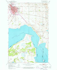
1951 Map of Devils Lake
USGS Topo · Published 1951About this map
The city of Devils Lake serves as the focal point for this mid-century survey, revealing a landscape defined by institutional growth and proximity to the shifting shoreline of Devils Lake. The urban grid is dense with civic and social history, featuring the State School for Deaf, St Marys Academy, and the Odd Fellows Home. Transportation infrastructure is prominently marked by the Great Northern railroad and the Minneapolis St Paul and Sault Ste Marie line crossing the northern reaches. Outside the city limits, the terrain transitions into township divisions such as Creel and Minnewaukan, where several rural landmarks like School No 1 (Abandoned) and the GAR Cem indicate the earlier era of settlement. The receding waters of the lake expose extensive Gravel Pits and the Approximate Boundary line, highlighting the region's complex environmental and surveying history near Mission Bay.
Find a feature on this map
30 named features on this map. Tap any name to fly to it.
Don’t see what you’re looking for? This feature index may not catch every label — zoom into the map to look around manually.
Map Details
Editions of this 1951 Devils Lake Map
2 editions found
Other maps of this area

1928 · Tokio
USGS Topo · 1:62,500

1930 · Hamar
USGS Topo · 1:62,500

1931 · Tokio
USGS Topo · 1:62,500

1931 · Devils Lake
USGS Topo · 1:62,500

1950 · Tokio
USGS Topo · 1:24,000

1950 · Devils Lake
USGS Topo · 1:62,500

1951 · Crary
USGS Topo · 1:24,000

1951 · Grand Harbor
USGS Topo · 1:24,000

1951 · Camp Grafton
USGS Topo · 1:24,000

1951 · Free Peoples Lake
USGS Topo · 1:24,000