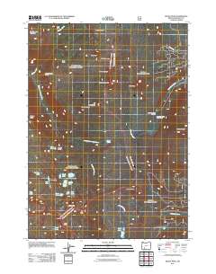
2011 Map of Devils Peak
USGS Topo · Published 2011About this map
Seven Lakes Basin anchors this high-elevation landscape in Klamath County, where the alpine geography transitions into the Oregon Desert to the north. The area is defined by its cluster of named waters, including North Lake, Grass Lake, and Cliff Lake, all situated under the watch of Devils Peak and Lee Peak. Seasonal encampments and stops like McKie Camp, Solace Camp, and Lone Wolf suggest a long history of use by travelers and forest workers moving through the backcountry.
Find a feature on this map
44 named features on this map. Tap any name to fly to it.
Don’t see what you’re looking for? This feature index may not catch every label — zoom into the map to look around manually.
Map Details
Editions of this 2011 Devils Peak Map
This is the sole edition of this map. No revisions or reprints were ever made.
Other maps of this area

1891 · Ashland
USGS Topo · 1:250,000

1893 · Ashland
USGS Topo · 1:250,000

1897 · Ashland
USGS Topo · 1:250,000

1955 · Rustler Peak
USGS Topo · 1:62,500

1955 · Pelican Butte
USGS Topo · 1:62,500

1955 · Medford
USGS Topo · 1:250,000

1956 · Prospect
USGS Topo · 1:62,500

1957 · Medford
USGS Topo · 1:250,000

1958 · Medford
USGS Topo · 1:250,000
1985 · Rustler Peak
USGS Topo · 1:24,000