
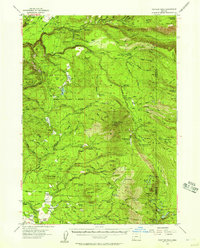
1955 Map of Rustler Peak
USGS Topo · Published 1957About this map
Prospect marks the northwestern corner of this mid-century survey, situated where the Middle Fork Rogue River and South Fork Rogue River begin their descent through the Cascades. The landscape is defined by its industrial and agricultural footprint, from the Copco Powerhouse near Daniel Creek to the network of logging roads and ranch lands. Family holdings are prominently documented across the terrain, including the Thomson Ranch, Clement Ranch, and Hoffman Ranch, illustrating the settlement patterns of eastern Jackson County before modern development intensified.
Find a feature on this map
144 named features on this map. Tap any name to fly to it.
Don’t see what you’re looking for? This feature index may not catch every label — zoom into the map to look around manually.
Map Details
Editions of this 1955 Rustler Peak Map
3 editions found
Other maps of this area

1891 · Ashland
USGS Topo · 1:250,000

1893 · Ashland
USGS Topo · 1:250,000

1897 · Ashland
USGS Topo · 1:250,000

1938 · Medford
USGS Topo · 1:125,000

1944 · Abbott Butte
USGS Topo · 1:62,500

1947 · Abbott Butte
USGS Topo · 1:62,500

1954 · Butte Falls
USGS Topo · 1:62,500

1954 · Lakecreek
USGS Topo · 1:62,500

1955 · Lake O' Woods
USGS Topo · 1:62,500

1955 · Mt. Mc Loughlin
USGS Topo · 1:62,500