
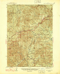
1947 Map of Abbott Butte
USGS Topo · Published 1947About this map
Rogue River National Forest defines the geography of this mid-century survey, a landscape where early twentieth-century industry and forest management left distinct marks across the ridge lines. The Al Sarena (Buzzard) Mine stands as a primary point of interest, illustrating the era's mining activity near the Douglas and Jackson county line. The map captures a network of service points and seasonal encampments, from the Dumont Ranger Sta and Matthews Guard Sta to remote sites like Five Sticks Camp and Freezeout Camp.
Find a feature on this map
121 named features on this map. Tap any name to fly to it.
Don’t see what you’re looking for? This feature index may not catch every label — zoom into the map to look around manually.
Map Details
Editions of this 1947 Abbott Butte Map
2 editions found
Other maps of this area

1891 · Ashland
USGS Topo · 1:250,000

1893 · Ashland
USGS Topo · 1:250,000

1897 · Ashland
USGS Topo · 1:250,000

1917 · Diamond Lake
USGS Topo · 1:125,000

1943 · Trail
USGS Topo · 1:62,500

1944 · Tiller
USGS Topo · 1:62,500

1944 · Abbott Butte
USGS Topo · 1:62,500

1954 · Butte Falls
USGS Topo · 1:62,500

1955 · Quartz Mtn
USGS Topo · 1:62,500

1955 · Red Butte
USGS Topo · 1:62,500