
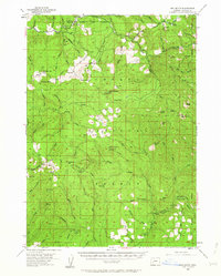
1955 Map of Red Butte
USGS Topo · Published 1957About this map
Umpqua National Forest defines the character of this mid-century survey, revealing a landscape dedicated to timber management, recreation, and early mountain industry. In the north, Wolf Creek Guard Sta and the nearby Training Camp and Boy Scout Camp at Sugar Pine Flat show the area's development for public and community use. To the south, extractive history is visible at the Umpqua Mine and Maude S Mine, located along the drainages feeding the Umpqua River.
Find a feature on this map
76 named features on this map. Tap any name to fly to it.
Don’t see what you’re looking for? This feature index may not catch every label — zoom into the map to look around manually.
Map Details
Editions of this 1955 Red Butte Map
2 editions found
Other maps of this area

1891 · Ashland
USGS Topo · 1:250,000

1893 · Ashland
USGS Topo · 1:250,000

1897 · Roseburg
USGS Topo · 1:125,000

1897 · Ashland
USGS Topo · 1:250,000

1900 · Roseburg
USGS Topo · 1:125,000

1904 · Riddle
USGS Topo · 1:125,000

1944 · Tiller
USGS Topo · 1:62,500

1944 · Abbott Butte
USGS Topo · 1:62,500

1947 · Abbott Butte
USGS Topo · 1:62,500

1954 · Dixonville
USGS Topo · 1:62,500