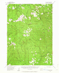
1955 Map of Red Butte
USGS Topo · Published 1963About this map
The Umpqua National Forest dominates this mid-1950s landscape, where a network of fire lookouts and forest service stations managed the timbered ridges of Douglas County. From the Wolf Creek Guard Sta in the north to the Windy Camp Lookout further south, the map reveals a remote geography of utility and wilderness management. Traces of human activity are concentrated around tactical outposts and small clearings like the Boy Scout Camp Sugar Pine Flat and Peter Paul Prairie.
Find a feature on this map
74 named features on this map. Tap any name to fly to it.
Don’t see what you’re looking for? This feature index may not catch every label — zoom into the map to look around manually.
Map Details
Editions of this 1955 Red Butte Map
2 editions found

Other maps of this area

1891 · Ashland
USGS Topo · 1:250,000

1893 · Ashland
USGS Topo · 1:250,000

1897 · Roseburg
USGS Topo · 1:125,000

1897 · Ashland
USGS Topo · 1:250,000

1900 · Roseburg
USGS Topo · 1:125,000

1904 · Riddle
USGS Topo · 1:125,000

1944 · Tiller
USGS Topo · 1:62,500

1944 · Abbott Butte
USGS Topo · 1:62,500

1947 · Abbott Butte
USGS Topo · 1:62,500

1954 · Dixonville
USGS Topo · 1:62,500