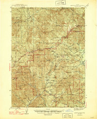
1947 Map of Abbott Butte
USGS Topo · Published 1947About this map
Abbott Butte stands as the central landmark in this mid-century survey of the high country spanning the Douglas and Jackson line. The map documents an era of active federal forest management and remote ranching, with infrastructure like the Dumont Ranger Sta, Matthews Guard Sta, and the Bald Mtn Lookout positioned across the landscape. The terrain is a network of named drainages including Elk Creek, Bitter Lick Creek, and Deadhorse Creek that cut through prominent features like Quartz Mtn and Donegan Prairies.
Find a feature on this map
118 named features on this map. Tap any name to fly to it.
Don’t see what you’re looking for? This feature index may not catch every label — zoom into the map to look around manually.
Map Details
Editions of this 1947 Abbott Butte Map
2 editions found
Other maps of this area

1891 · Ashland
USGS Topo · 1:250,000

1893 · Ashland
USGS Topo · 1:250,000

1897 · Ashland
USGS Topo · 1:250,000

1917 · Diamond Lake
USGS Topo · 1:125,000

1943 · Trail
USGS Topo · 1:62,500

1944 · Tiller
USGS Topo · 1:62,500

1944 · Abbott Butte
USGS Topo · 1:62,500

1947 · Abbott Butte
USGS Topo · 1:62,500

1954 · Butte Falls
USGS Topo · 1:62,500

1955 · Quartz Mtn
USGS Topo · 1:62,500