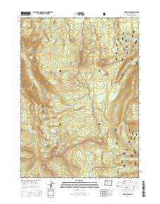
2014 Map of Devils Peak
USGS Topo · Published 2014About this map
Seven Lakes Basin defines the high-altitude character of this portion of the Southern Cascades, where a cluster of alpine water bodies including Lake Ivern, Cliff Lake, and N Lake sit below the surrounding ridges. The terrain is marked by prominent volcanic features with evocative names such as Devils Peak, Lucifer, Venus, and Jupiter. This landscape serves as a meeting point for two major protected areas, with the boundary between Rogue River National Forest and Winema National Forest running through the center of the map. The Pacific Crest National Scenic Trail winds through these forests, providing the primary path for navigating the steep elevation changes between Boston Bluff and Gopher Ridge. From the high point at Klamath Point to the headwaters of the Middle Fork Rogue River, the map captures a wilderness area shaped by glaciation and geological activity.
Find a feature on this map
47 named features on this map. Tap any name to fly to it.
Don’t see what you’re looking for? This feature index may not catch every label — zoom into the map to look around manually.
Map Details
Editions of this 2014 Devils Peak Map
This is the sole edition of this map. No revisions or reprints were ever made.
Other maps of this area

1891 · Ashland
USGS Topo · 1:250,000

1893 · Ashland
USGS Topo · 1:250,000

1897 · Ashland
USGS Topo · 1:250,000

1955 · Rustler Peak
USGS Topo · 1:62,500

1955 · Pelican Butte
USGS Topo · 1:62,500

1955 · Medford
USGS Topo · 1:250,000

1956 · Prospect
USGS Topo · 1:62,500

1957 · Medford
USGS Topo · 1:250,000

1958 · Medford
USGS Topo · 1:250,000
1985 · Rustler Peak
USGS Topo · 1:24,000