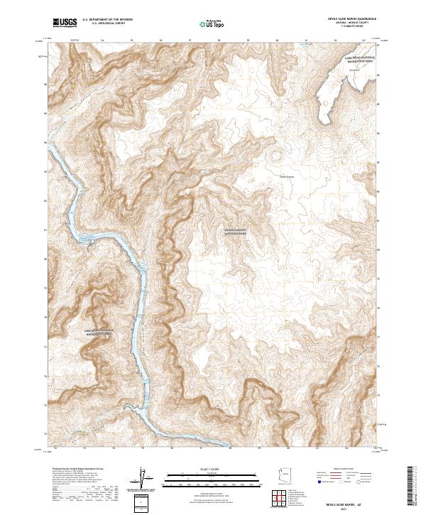
2021 Map of Devils Slide Rapids
USGS Topo · Published 2021About this map
The Colorado River carves a deep path through the Lower Granite Gorge on this contemporary survey of the Arizona wilderness. This stretch of the river is defined by its series of numbered whitewater challenges, including 210-Mile Rapids, 211-Mile Rapids, and the eponymous Devils Slide Rapids. The topography is dominated by the steep elevation changes between the Sanup Plateau and the riverbed, with numerous drainage systems like Burnt Canyon and Surprise Canyon cutting through the rock layers.
Find a feature on this map
26 named features on this map. Tap any name to fly to it.
Don’t see what you’re looking for? This feature index may not catch every label — zoom into the map to look around manually.
Map Details
Editions of this 2021 Devils Slide Rapids Map
This is the sole edition of this map. No revisions or reprints were ever made.
Other maps of this area

1886 · Diamond Creek
USGS Topo · 1:250,000

1886 · Mt. Trumbull
USGS Topo · 1:250,000

1892 · Diamond Creek
USGS Topo · 1:250,000

1892 · Mt. Trumbull
USGS Topo · 1:250,000

1948 · Williams
USGS Topo · 1:250,000

1953 · Grand Canyon
USGS Topo · 1:250,000

1954 · Williams
USGS Topo · 1:250,000

1956 · Williams
USGS Topo · 1:250,000

1957 · Grand Canyon
USGS Topo · 1:250,000

1958 · Grand Canyon
USGS Topo · 1:250,000