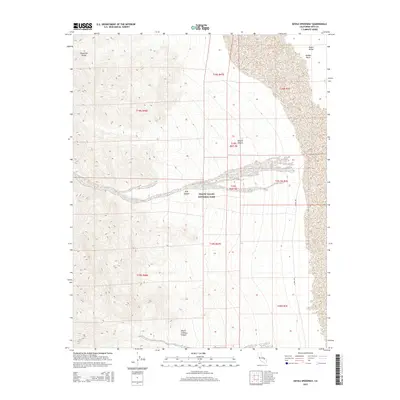
2015 Map of Devils Speedway
USGS Topo · Published 2015About this map
Panamint Range heights descend into the deep topography of Death Valley National Park, where dramatic alluvial fans and canyon mouths define the desert landscape. This 2015 study focuses on the stark transition from the high western peaks down to the Middle Basin within the heart of Death Valley. The drainage patterns of Trail Canyon and Death Valley Canyon are clearly articulated as they spill toward the valley floor, illustrating the complex erosional forces of the Mojave Desert. On the eastern edge of the quadrangle, the W Side Rd provides a north-south transit route through the basin, following the base of the mountain front. This map effectively captures the geological interface between the uplifted ranges and the subsiding basin floor during the early twenty-first century.
Find a feature on this map
17 named features on this map. Tap any name to fly to it.
Don’t see what you’re looking for? This feature index may not catch every label — zoom into the map to look around manually.
Map Details
Editions of this 2015 Devils Speedway Map
This is the sole edition of this map. No revisions or reprints were ever made.
Other maps of this area

1908 · Furnace Creek
USGS Topo · 1:250,000

1908 · Ballarat
USGS Topo · 1:250,000

1910 · Furnace Creek
USGS Topo · 1:250,000

1913 · Ballarat
USGS Topo · 1:250,000

1948 · Death Valley
USGS Topo · 1:250,000

1952 · Furnace Creek
USGS Topo · 1:62,500

1952 · Bennetts Well
USGS Topo · 1:62,500

1952 · Telescope Peak
USGS Topo · 1:62,500

1952 · Emigrant Canyon
USGS Topo · 1:62,500

1954 · Death Valley
USGS Topo · 1:250,000