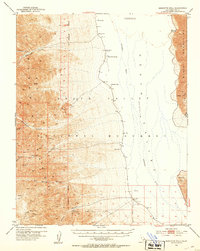
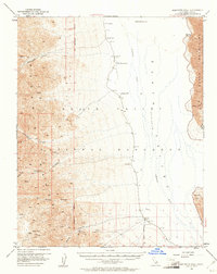
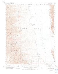
1952 Map of Bennetts Well
USGS Topo · Published 1953About this map
The extreme verticality of Death Valley is on full display here, where the land drops below sea level between the Panamint Range and the Black Mountains. Life in this arid basin during the mid-century was defined by isolated water sources such as Bennetts Well, Shortys Well, and Eagle Borax Spring, which served as vital landmarks for travel across the valley floor. The map documents the intricate drainage systems carved into the mountains, including Hanaupah Canyon and Johnson Canyon, which terminate in the basin of the Amargosa River. Industrial activity is noted in the southern reaches at the Talc Mines near Gold Hill, illustrating the remote extractive operations of the era. From the low point at Badwater to the high ridges of the western range, the sheet provides a meticulous record of the specialized infrastructure, like the Gravity Station and Salt Well Tanks, required to navigate and survey this unforgiving landscape.
Find a feature on this map
28 named features on this map. Tap any name to fly to it.
Don’t see what you’re looking for? This feature index may not catch every label — zoom into the map to look around manually.
Map Details
Editions of this 1952 Bennetts Well Map
3 editions found
Other maps of this area

1908 · Furnace Creek
USGS Topo · 1:250,000

1908 · Ballarat
USGS Topo · 1:250,000

1910 · Furnace Creek
USGS Topo · 1:250,000

1913 · Ballarat
USGS Topo · 1:250,000

1915 · Searles Lake
USGS Topo · 1:250,000

1933 · Avawatz Mountains
USGS Topo · 1:250,000

1947 · Trona
USGS Topo · 1:250,000

1948 · Trona
USGS Topo · 1:250,000

1948 · Death Valley
USGS Topo · 1:250,000
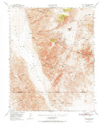
1950 · Manly Peak
USGS Topo · 1:62,500