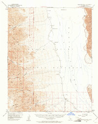
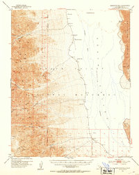
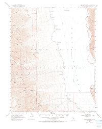
1952 Map of Bennetts Well
USGS Topo · Published 1961About this map
Death Valley dominates this 1952 field-checked survey, capturing the stark landscape of the eastern Mojave. The map centers on the Amargosa River basin, reaching the lowest elevation in the U.S. at 282 feet below sea level. Survival in this environment is marked by scattered water sources like Bennetts Well, Eagle Borax Spring, and Tule Spring, which provided essential stops for early travelers and prospectors.
Find a feature on this map
23 named features on this map. Tap any name to fly to it.
Don’t see what you’re looking for? This feature index may not catch every label — zoom into the map to look around manually.
Map Details
Editions of this 1952 Bennetts Well Map
3 editions found
Other maps of this area

1908 · Furnace Creek
USGS Topo · 1:250,000

1908 · Ballarat
USGS Topo · 1:250,000

1910 · Furnace Creek
USGS Topo · 1:250,000

1913 · Ballarat
USGS Topo · 1:250,000

1915 · Searles Lake
USGS Topo · 1:250,000

1933 · Avawatz Mountains
USGS Topo · 1:250,000

1947 · Trona
USGS Topo · 1:250,000

1948 · Trona
USGS Topo · 1:250,000

1948 · Death Valley
USGS Topo · 1:250,000
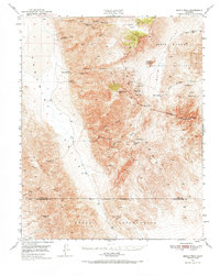
1950 · Manly Peak
USGS Topo · 1:62,500