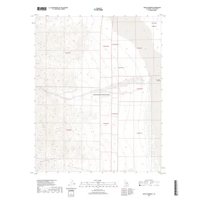
2018 Map of Devils Speedway
USGS Topo · Published 2018About this map
Death Valley National Park encompasses this stark desert landscape, where the dramatic elevation changes of the Amargosa Range meet the salt-crusted floor of the Middle Basin. The map highlights a unique geological intersection where drainage from Trail Canyon and Death Valley Canyon spills toward the floor of Death Valley. To the east, the Devils Speedway marks a notable expanse of the Mojave Desert terrain, characterized by its isolation and the presence of Salt Creek. This 2018 survey detail provides an accurate view of the township and range lines, such as t18s r47e, that define the administrative boundaries within this protected wilderness. The drainage patterns and topography documented here show how water moving through the deep canyons interacts with the playa environment during the rare periods of desert runoff.
Find a feature on this map
17 named features on this map. Tap any name to fly to it.
Don’t see what you’re looking for? This feature index may not catch every label — zoom into the map to look around manually.
Map Details
Editions of this 2018 Devils Speedway Map
This is the sole edition of this map. No revisions or reprints were ever made.
Other maps of this area

1908 · Furnace Creek
USGS Topo · 1:250,000

1908 · Ballarat
USGS Topo · 1:250,000

1910 · Furnace Creek
USGS Topo · 1:250,000

1913 · Ballarat
USGS Topo · 1:250,000

1948 · Death Valley
USGS Topo · 1:250,000

1952 · Furnace Creek
USGS Topo · 1:62,500

1952 · Bennetts Well
USGS Topo · 1:62,500

1952 · Telescope Peak
USGS Topo · 1:62,500

1952 · Emigrant Canyon
USGS Topo · 1:62,500

1954 · Death Valley
USGS Topo · 1:250,000