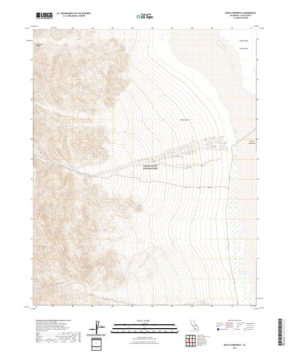
2021 Map of Devils Speedway
USGS Topo · Published 2021About this map
Death Valley National Park encompasses the stark geological transitions of this desert landscape, where the rugged peaks of the Panamint Range descend into the low-lying reaches of Death Valley. The map highlights several dramatic drainage features, including Trail Canyon and Death Valley Canyon, which carve through the western alluvial fans toward the valley floor. To the east, the terrain levels out into the Mojave Desert and the Middle Basin, a region characterized by ephemeral water systems like Salt Cr. The eponymous Devils Speedway is located on the eastern edge of the quadrangle, reflecting the unique salt pan and mudflat surfaces that define this portion of the basin. This survey provides a precise look at the township and range grid system as it overlays the natural topography of one of the lowest and driest environments in North America.
Find a feature on this map
18 named features on this map. Tap any name to fly to it.
Don’t see what you’re looking for? This feature index may not catch every label — zoom into the map to look around manually.
Map Details
Editions of this 2021 Devils Speedway Map
This is the sole edition of this map. No revisions or reprints were ever made.
Other maps of this area

1908 · Furnace Creek
USGS Topo · 1:250,000

1908 · Ballarat
USGS Topo · 1:250,000

1910 · Furnace Creek
USGS Topo · 1:250,000

1913 · Ballarat
USGS Topo · 1:250,000

1948 · Death Valley
USGS Topo · 1:250,000

1952 · Furnace Creek
USGS Topo · 1:62,500

1952 · Bennetts Well
USGS Topo · 1:62,500

1952 · Telescope Peak
USGS Topo · 1:62,500

1952 · Emigrant Canyon
USGS Topo · 1:62,500

1954 · Death Valley
USGS Topo · 1:250,000