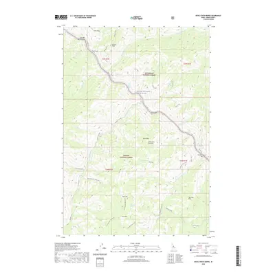
2020 Map of Devils Teeth Rapids
USGS Topo · Published 2020About this map
Salmon Wild and Scenic River corridors define this portion of the Salmon River Mountains, where steep canyon walls and river bars create a landscape shaped by water and elevation. The river's path is marked by significant navigational hazards including Devils Teeth Rapids and Little Devils Teeth Rapids, which provided the namesake for this area. This 2020 survey documents the intersection of several major federal land units, including the Bitterroot National Forest and Payette National Forest.
Find a feature on this map
45 named features on this map. Tap any name to fly to it.
Don’t see what you’re looking for? This feature index may not catch every label — zoom into the map to look around manually.
Map Details
Editions of this 2020 Devils Teeth Rapids Map
This is the sole edition of this map. No revisions or reprints were ever made.
Other maps of this area

1956 · Elk City
USGS Topo · 1:250,000

1960 · Elk City
USGS Topo · 1:250,000

1977 · Cottonwood Butte
USGS Topo · 1:24,000

1978 · Waugh Mountain
USGS Topo · 1:24,000

1978 · Arctic Point
USGS Topo · 1:24,000

1978 · Dennis Mtn
USGS Topo · 1:24,000

1978 · Wapiti Creek
USGS Topo · 1:24,000

1978 · Sheep Hill
USGS Topo · 1:24,000

1978 · Devils Teeth Rapids
USGS Topo · 1:24,000
1979 · Cold Meadows
USGS Topo · 1:24,000