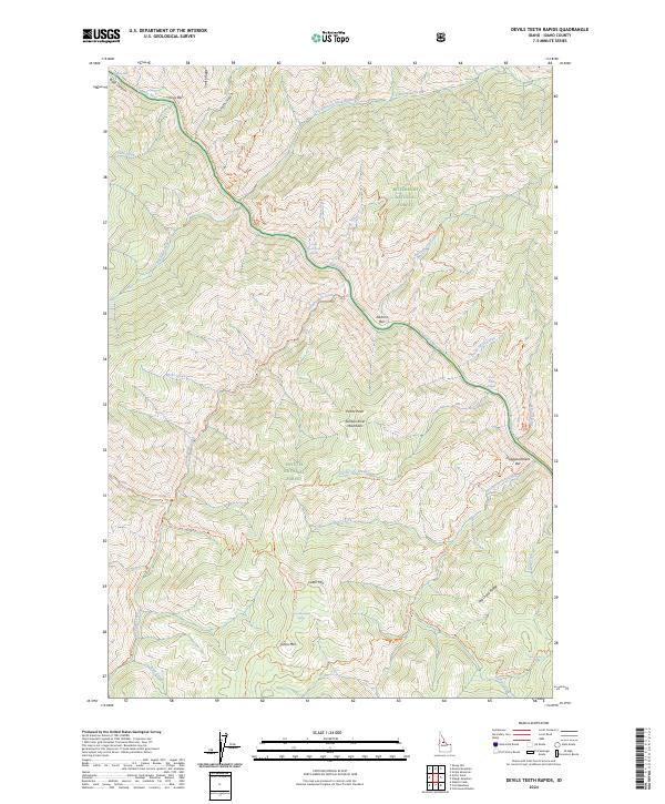
2024 Map of Devils Teeth Rapids
USGS Topo · Published 2024About this map
The Salmon River carves a deep path through the Salmon River Mountains, marking a landscape defined by dramatic elevation changes and white-water features. This stretch of river is characterized by the formidable Devils Teeth Rapids and Little Devils Teeth Rapids, which create significant navigational challenges. The riverbanks are dotted with named alluvial bars such as Corey Bar, Elkhorn Bar, and Disappointment Bar, hinting at the history of river travel and potential early prospecting sites along the water's edge.
Find a feature on this map
52 named features on this map. Tap any name to fly to it.
Don’t see what you’re looking for? This feature index may not catch every label — zoom into the map to look around manually.
Map Details
Editions of this 2024 Devils Teeth Rapids Map
This is the sole edition of this map. No revisions or reprints were ever made.
Other maps of this area

1956 · Elk City
USGS Topo · 1:250,000

1960 · Elk City
USGS Topo · 1:250,000

1977 · Cottonwood Butte
USGS Topo · 1:24,000

1978 · Waugh Mountain
USGS Topo · 1:24,000

1978 · Arctic Point
USGS Topo · 1:24,000

1978 · Dennis Mtn
USGS Topo · 1:24,000

1978 · Wapiti Creek
USGS Topo · 1:24,000

1978 · Sheep Hill
USGS Topo · 1:24,000

1978 · Devils Teeth Rapids
USGS Topo · 1:24,000
1979 · Cold Meadows
USGS Topo · 1:24,000