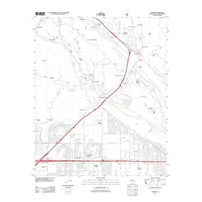
2012 Map of Devore
USGS Topo · Published 2012About this map
Mormon Battalion Mountain and the steep ridges of the San Bernardino National Forest overlook the transition from rugged canyons to the expanding suburban landscape of North Fontana. This map documents a critical transportation corridor where Cajon Blvd and the interstate system navigate the natural passage of Cajon Canyon and Sycamore Canyon. The contrast between the undeveloped northern reaches, featuring landmarks like San Sevaine Lookout and Pitman Canyon, and the dense residential grids of Sierra Heights and Walnut Ridge to the south illustrates the rapid urbanization of the Inland Empire. Significant infrastructure and community markers, including the Rialto Municipal Airport, the Glen Helen Rehabilitation Facility, and the settlement at Devore, anchor the landscape. Water resources like Stone Reservoir and the drainage of Lytle Cr Wash define the hydrology of this semi-arid region at the foot of the mountains.
Find a feature on this map
116 named features on this map. Tap any name to fly to it.
Don’t see what you’re looking for? This feature index may not catch every label — zoom into the map to look around manually.
Map Details
Editions of this 2012 Devore Map
This is the sole edition of this map. No revisions or reprints were ever made.
Other maps of this area

1896 · San Bernardino
USGS Topo · 1:62,500

1897 · Cucamonga
USGS Topo · 1:62,500

1898 · San Bernardino
USGS Topo · 1:62,500

1900 · Cucamonga
USGS Topo · 1:62,500

1901 · Southern California Sheet No. 1
USGS Topo · 1:250,000

1901 · San Bernardino
USGS Topo · 1:62,500

1902 · Hesperia
USGS Topo · 1:62,500

1903 · Cucamonga
USGS Topo · 1:62,500

1903 · San Antonio
USGS Topo · 1:62,500

1904 · Southern California Sheet No. 1
USGS Topo · 1:250,000