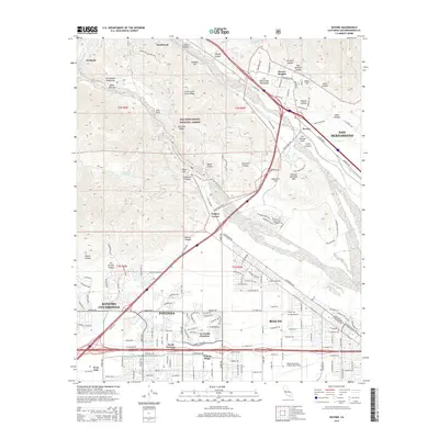
2015 Map of Devore
USGS Topo · Published 2015About this map
The San Andreas Fault cuts a diagonal path through this landscape where the San Gabriel Mountains and San Bernardino Mountains converge. This 2015 survey illustrates the intense urban expansion in the southern half of the quadrangle, where the residential grids of Fontana, Rancho Cucamonga, and Rialto meet at the base of the mountains. A significant portion of the land is dedicated to the San Bernardino National Forest, protecting the complex topography of Cajon Canyon and Sycamore Canyon. Transportation is a dominant theme, with the high-traffic corridors of Cajon Blvd and the San Bernardino rail lines navigating the narrow pass between mountain ranges. Local history is reflected in smaller settlements like Keenbrook and Devore, while the Rialto Municipal Airport/Miro Field stands as a prominent landmark on the valley floor.
Find a feature on this map
162 named features on this map. Tap any name to fly to it.
Don’t see what you’re looking for? This feature index may not catch every label — zoom into the map to look around manually.
Map Details
Editions of this 2015 Devore Map
This is the sole edition of this map. No revisions or reprints were ever made.
Other maps of this area

1896 · San Bernardino
USGS Topo · 1:62,500

1897 · Cucamonga
USGS Topo · 1:62,500

1898 · San Bernardino
USGS Topo · 1:62,500

1900 · Cucamonga
USGS Topo · 1:62,500

1901 · Southern California Sheet No. 1
USGS Topo · 1:250,000

1901 · San Bernardino
USGS Topo · 1:62,500

1902 · Hesperia
USGS Topo · 1:62,500

1903 · Cucamonga
USGS Topo · 1:62,500

1903 · San Antonio
USGS Topo · 1:62,500

1904 · Southern California Sheet No. 1
USGS Topo · 1:250,000