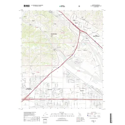
2018 Map of Devore
USGS Topo · Published 2018About this map
The San Andreas Fault cuts a diagonal path through this landscape, marking the structural boundary between the San Gabriel Mountains and the San Bernardino Mountains. This geological divide defines the rugged topography of the San Bernardino National Forest, where steep canyons like Cable Canyon and Meyer Canyon descend toward the valley floor. The map captures the transition from these wild heights to the suburban expansion of Fontana, Rialto, and Rancho Cucamonga in the south.
Find a feature on this map
135 named features on this map. Tap any name to fly to it.
Don’t see what you’re looking for? This feature index may not catch every label — zoom into the map to look around manually.
Map Details
Editions of this 2018 Devore Map
This is the sole edition of this map. No revisions or reprints were ever made.
Other maps of this area

1896 · San Bernardino
USGS Topo · 1:62,500

1897 · Cucamonga
USGS Topo · 1:62,500

1898 · San Bernardino
USGS Topo · 1:62,500

1900 · Cucamonga
USGS Topo · 1:62,500

1901 · Southern California Sheet No. 1
USGS Topo · 1:250,000

1901 · San Bernardino
USGS Topo · 1:62,500

1902 · Hesperia
USGS Topo · 1:62,500

1903 · Cucamonga
USGS Topo · 1:62,500

1903 · San Antonio
USGS Topo · 1:62,500

1904 · Southern California Sheet No. 1
USGS Topo · 1:250,000