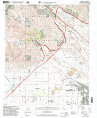
1996 Map of Devore
USGS Topo · Published 1999About this map
The Muscupiabe Grant serves as a historical backdrop for this mid-1990s landscape, where the San Bernardino mountains meet the expanding industrial and residential grids of Southern California. The drainage of Lytle Creek and Cajon Creek dictates the geography, while the Barstow Freeway and heavy rail lines like the Atchison Topeka and Santa Fe carve through the foothills. Notable local landmarks include the Gilfillan Airport and the Glen Helen Rehabilitation Facility, illustrating the diverse land use of the era.
Find a feature on this map
47 named features on this map. Tap any name to fly to it.
Don’t see what you’re looking for? This feature index may not catch every label — zoom into the map to look around manually.
Map Details
Editions of this 1996 Devore Map
This is the sole edition of this map. No revisions or reprints were ever made.
Other maps of this area

1896 · San Bernardino
USGS Topo · 1:62,500

1897 · Cucamonga
USGS Topo · 1:62,500

1898 · San Bernardino
USGS Topo · 1:62,500

1900 · Cucamonga
USGS Topo · 1:62,500

1901 · Southern California Sheet No. 1
USGS Topo · 1:250,000

1901 · San Bernardino
USGS Topo · 1:62,500

1902 · Hesperia
USGS Topo · 1:62,500

1903 · Cucamonga
USGS Topo · 1:62,500

1903 · San Antonio
USGS Topo · 1:62,500

1904 · Southern California Sheet No. 1
USGS Topo · 1:250,000