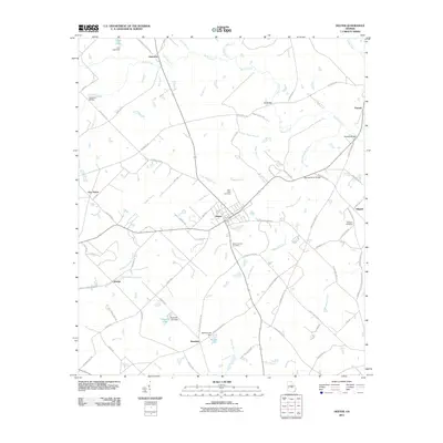
2011 Map of Dexter
USGS Topo · Published 2011About this map
Dexter serves as the central hub of this Laurens County landscape, where rural road networks converge near Saint Lukes Cemetery and Mount Carmel Cemetery. The terrain is defined by a dense web of waterways, most notably the meandering Stitchihatchie Creek and its various tributaries like Big Stitchihatchie Branch and Little Boggy Branch. These streams dictate the placement of local crossings such as Buckhorn Bridge and Spring Haven Bridge.
Find a feature on this map
80 named features on this map. Tap any name to fly to it.
Don’t see what you’re looking for? This feature index may not catch every label — zoom into the map to look around manually.
Map Details
Editions of this 2011 Dexter Map
This is the sole edition of this map. No revisions or reprints were ever made.
Other maps of this area

1957 · Macon
USGS Topo · 1:250,000

1958 · Macon
USGS Topo · 1:250,000

1964 · Macon
USGS Topo · 1:250,000

1973 · Cadwell
USGS Topo · 1:24,000

1974 · Chester
USGS Topo · 1:24,000

1974 · Danville East
USGS Topo · 1:24,000

1974 · Five Points
USGS Topo · 1:24,000

1974 · Rentz
USGS Topo · 1:24,000

1974 · Dudley
USGS Topo · 1:24,000
1974 · Yonkers
USGS Topo · 1:24,000