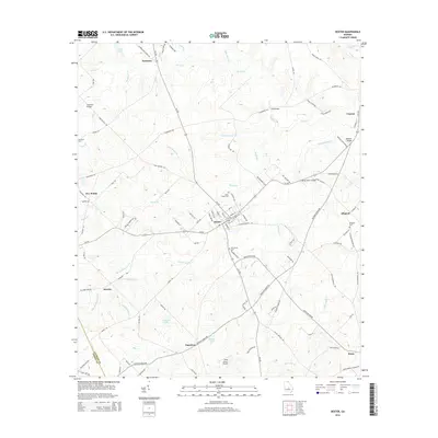
2014 Map of Dexter
USGS Topo · Published 2014About this map
Dexter and Rentz anchor this central Georgia landscape, where agricultural land meets the winding tributaries of the Oconee River basin. The map reveals a network of small settlements and family-named locales, such as Kewanee, Alcorns, and the curiously named Nameless, reflecting a long history of rural community life in Laurens County. Significant local history is preserved in the locations of Mt Carmel Cem, Saint Lukes Cem, and Buckhorn Cem, providing clear geographic markers for genealogical research.
Find a feature on this map
107 named features on this map. Tap any name to fly to it.
Don’t see what you’re looking for? This feature index may not catch every label — zoom into the map to look around manually.
Map Details
Editions of this 2014 Dexter Map
This is the sole edition of this map. No revisions or reprints were ever made.
Other maps of this area

1957 · Macon
USGS Topo · 1:250,000

1958 · Macon
USGS Topo · 1:250,000

1964 · Macon
USGS Topo · 1:250,000

1973 · Cadwell
USGS Topo · 1:24,000

1974 · Chester
USGS Topo · 1:24,000

1974 · Danville East
USGS Topo · 1:24,000

1974 · Five Points
USGS Topo · 1:24,000

1974 · Rentz
USGS Topo · 1:24,000

1974 · Dudley
USGS Topo · 1:24,000
1974 · Yonkers
USGS Topo · 1:24,000