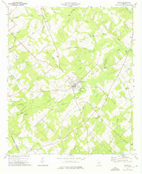
1974 Map of Dexter
USGS Topo · Published 1976About this map
The town of Dexter serves as the central hub of this Georgia landscape, situated where several local routes and an Old Railroad Grade converge. This 1974 survey reveals a rural network defined by its small crossroads and family-named watercourses, such as Gin House Br and Scooter Route Branch. The map records numerous community landmarks significant to local genealogy, including St Lukes Cem, Beulah Hill Ch, and the Alligood Cem near the eastern boundary.
Find a feature on this map
49 named features on this map. Tap any name to fly to it.
Don’t see what you’re looking for? This feature index may not catch every label — zoom into the map to look around manually.
Map Details
Editions of this 1974 Dexter Map
This is the sole edition of this map. No revisions or reprints were ever made.
Other maps of this area

1957 · Macon
USGS Topo · 1:250,000

1958 · Macon
USGS Topo · 1:250,000

1964 · Macon
USGS Topo · 1:250,000

1973 · Cadwell
USGS Topo · 1:24,000

1974 · Chester
USGS Topo · 1:24,000

1974 · Danville East
USGS Topo · 1:24,000

1974 · Five Points
USGS Topo · 1:24,000

1974 · Rentz
USGS Topo · 1:24,000

1974 · Dudley
USGS Topo · 1:24,000
1974 · Yonkers
USGS Topo · 1:24,000