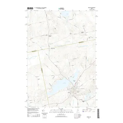
2014 Map of Dexter
USGS Topo · Published 2014About this map
Lake Wassookeag dominates this landscape, serving as the central hub around which the town of Dexter is established. The settlement pattern follows the drainage of the E Br Sebasticook River, where industrial history is evidenced by Spooners Mill downstream. The township is characterized by several outlying historical nodes, including Jackman Corner, North Dexter, and Gilman Corner, each once serving as localized community centers for the surrounding farmsteads.
Find a feature on this map
106 named features on this map. Tap any name to fly to it.
Don’t see what you’re looking for? This feature index may not catch every label — zoom into the map to look around manually.
Map Details
Editions of this 2014 Dexter Map
This is the sole edition of this map. No revisions or reprints were ever made.
Other maps of this area

1930 · Pittsfield
USGS Topo · 1:48,000

1931 · Stetson
USGS Topo · 1:48,000

1932 · Dover-Foxcroft
USGS Topo · 1:48,000

1932 · Pittsfield
USGS Topo · 1:62,500

1933 · Pittsfield
USGS Topo · 1:62,500

1933 · Guilford
USGS Topo · 1:62,500

1935 · Dover-Foxcroft
USGS Topo · 1:62,500

1935 · Stetson
USGS Topo · 1:62,500

1937 · Guilford
USGS Topo · 1:62,500

1948 · Bangor
USGS Topo · 1:250,000