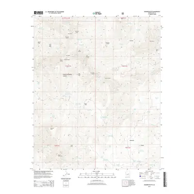
2014 Map of Diamond Butte
USGS Topo · Published 2014About this map
Tonto National Forest defines this high Arizona landscape, where the rugged topography of Gila County is marked by a complex system of canyons and ridges. The map captures the remote character of the region, anchored by the namesake Diamond Butte and the distinctive Hells Gate formation where watercourses converge. Evidence of land use and cattle ranching appears through numerous water catchments like Goswick Canyon Tank and Fuller Mesa Tank, alongside springs such as Peveler Chimney Spring. Small settlements like Spurlock and Young sit at the southern edge of the quadrangle, connected by Forest Service routes including NF-133. The map's detail provides a look at the drainage patterns of Spring Cr and Haigler Canyon, showing how the early 21st-century landscape remains shaped by its geography and agricultural infrastructure.
Find a feature on this map
68 named features on this map. Tap any name to fly to it.
Don’t see what you’re looking for? This feature index may not catch every label — zoom into the map to look around manually.
Map Details
Editions of this 2014 Diamond Butte Map
This is the sole edition of this map. No revisions or reprints were ever made.
Other maps of this area

1886 · Holbrook
USGS Topo · 1:250,000

1887 · Verde
USGS Topo · 1:250,000

1892 · Verde
USGS Topo · 1:250,000

1893 · Holbrook
USGS Topo · 1:250,000

1934 · Promontory Butte
USGS Topo · 1:62,500

1937 · Diamond Butte
USGS Topo · 1:48,000

1939 · Promontory Butte
USGS Topo · 1:62,500

1943 · Diamond Butte
USGS Topo · 1:62,500

1952 · Promontory Butte
USGS Topo · 1:62,500

1954 · Holbrook
USGS Topo · 1:250,000